 vesseltracker.com
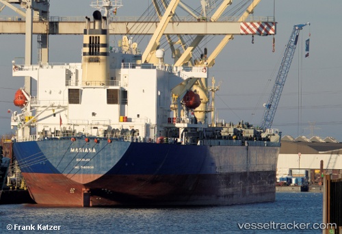
 OCEANA SKY
Current Status
Where is the vessel?
OCEANA SKY is currently in 58 nm W of As Salif, based on AIS data received about 14h ago.
Latest AIS update:
Current position: 15.43984° N, 41.67448° E (58 nm W of As Salif)
Average speed (last 7 days): Loading…
Average speed (last 30 days): Loading…
Vessel profile: OCEANA SKY is a General Cargo Ship with dimensions 195m x 195m.
This page combines live AIS, route history, probable destination signals, nearby traffic, and port activity for practical vessel monitoring.
The current position of vessel OCEANA SKY is 15.43984 lat / 41.67448 lng. Updated: 2026-05-18 13:27:30 UTCNearest reference points:
- 81 nm NW of As Salif
- 92 nm SW of Al Qahmah
- Near Jazan Economic City
Currently sailing under the flag of Panama ![]()
OCEANA SKY built in 1998 year
Deadweight:
50655 tDetails:
Live Vessel OCEANA SKY Analytics (details, animations, etc.)
Recent AIS points (UTC):
2026-05-18 04:37:51 UTC · 18.78179, 38.00757 · SOG 0 kn · COG 155°2026-05-18 10:28:05 UTC · 15.96326, 41.39151 · SOG 11.7 kn · COG 146°
2026-05-18 12:00:42 UTC · 15.69334, 41.54249 · SOG 11.8 kn · COG 152°
2026-05-18 13:27:30 UTC · 15.43984, 41.67448 · SOG 11.4 kn · COG 160°