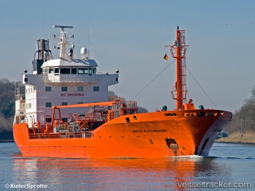
 EDITH ESSBERGER
Current Status
Where is the vessel?
EDITH ESSBERGER is currently in Near Town Quays/Drogheda, based on AIS data received about 14h ago.
Latest AIS update:
Current position: 53.73750° N, 6.28630° E (Near Town Quays/Drogheda)
Average speed (last 7 days): Loading…
Average speed (last 30 days): Loading…
Vessel profile: EDITH ESSBERGER is a Oil/Chemical Tanker with dimensions m x m.
This page combines live AIS, route history, probable destination signals, nearby traffic, and port activity for practical vessel monitoring.
The current position of vessel EDITH ESSBERGER is 53.73750 lat / 6.28630 lng. Updated: 2026-05-19 19:32:20 UTCNearest reference points:
- 14 nm NW of Town Quays/Drogheda
- Near Borkum
- Near Hoogkerk
Currently sailing under the flag of Portugal ![]()
Details:
Live Vessel EDITH ESSBERGER Analytics (details, animations, etc.)
Recent AIS points (UTC):
2026-05-19 16:21:09 UTC · 53.55126, 5.32971 · SOG 10.4 kn · COG 72°2026-05-19 17:22:50 UTC · 53.61042, 5.61778 · SOG 10.9 kn · COG 72°
2026-05-19 19:28:19 UTC · 53.73446, 6.26402 · SOG 12.1 kn · COG 77°
2026-05-19 19:32:20 UTC · 53.73750, 6.28630 · SOG 11.9 kn · COG 78°