 ALEXANDRA
Current Status
Where is the vessel?
ALEXANDRA is currently in 14 nm NW of Figuera Da Foz, based on AIS data received about 14h ago.
Latest AIS update:
Current position: 40.31951° N, 9.07087° W (14 nm NW of Figuera Da Foz)
Average speed (last 7 days): Loading…
Average speed (last 30 days): Loading…
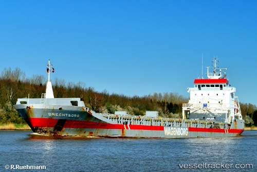
Vessel profile: ALEXANDRA is a General Cargo Ship with dimensions 133m x 16m.
This page combines live AIS, route history, probable destination signals, nearby traffic, and port activity for practical vessel monitoring.
The current position of vessel ALEXANDRA is 40.31951 lat / -9.07087 lng. Updated: 2026-05-20 22:13:52 UTCNearest reference points:
- Near Figuera Da Foz
- Near Gafanha da Nazaré
- Near Nazaré
Currently sailing under the flag of Barbados ![]()
ALEXANDRA built in 2000 year
Deadweight:
8865 tDetails:
Live Vessel ALEXANDRA Analytics (details, animations, etc.)
Recent AIS points (UTC):
2026-05-20 16:54:33 UTC · 40.65383, -8.71778 · SOG 0 kn · COG 262°2026-05-20 17:34:34 UTC · 40.65382, -8.71779 · SOG 0 kn · COG 263°
2026-05-20 22:06:13 UTC · 40.33996, -9.05257 · SOG 11.6 kn · COG 217°
2026-05-20 22:13:52 UTC · 40.31951, -9.07087 · SOG 11.6 kn · COG 208°