 vesseltracker.com
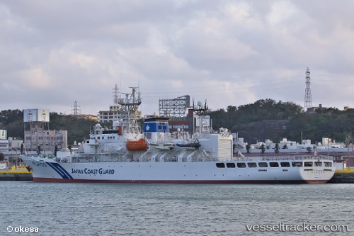
Ryukyu
Current StatusWhere is the vessel?
Ryukyu is currently in 23 nm NW of Miyakojima, based on AIS data received about 11d ago.
Latest AIS update:
Current position: 25.10838° N, 125.09130° E (23 nm NW of Miyakojima)
Average speed (last 7 days): Loading…
Average speed (last 30 days): Loading…
Vessel profile: Ryukyu is a Patrol Vessel with dimensions 14m x 105m.
This page combines live AIS, route history, probable destination signals, nearby traffic, and port activity for practical vessel monitoring.
The current position of vessel Ryukyu is 25.10838 lat / 125.09130 lng. Updated: 2026-05-07 14:59:31 UTCNearest reference points:
- 77 nm SE of Miyakojima
- 120 nm NE of Nangang
- 55 nm E of Nangang
Details:
Live Vessel Ryukyu Analytics (details, animations, etc.)
Recent AIS points (UTC):
2026-05-07 14:59:31 UTC · 25.10838, 125.09130 · SOG 17.2 kn · COG 240°2026-05-07 14:59:31 UTC · 25.10838, 125.09130 · SOG 17.2 kn · COG 240°
2026-05-07 14:59:31 UTC · 25.10838, 125.09130 · SOG 17.2 kn · COG 240°
2026-05-07 14:59:31 UTC · 25.10838, 125.09130 · SOG 17.2 kn · COG 240°