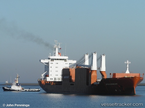
Spuigracht
Current StatusWhere is the vessel?
Spuigracht is currently in Near Vila do Conde Pt/Barcarena, based on AIS data received about 15h ago.
Latest AIS update:
Current position: 1.54948° S, 48.80452° W (Near Vila do Conde Pt/Barcarena)
Average speed (last 7 days): Loading…
Average speed (last 30 days): Loading…
Vessel profile: Spuigracht is a General Cargo Ship with dimensions 26m x 174m.
This page combines live AIS, route history, probable destination signals, nearby traffic, and port activity for practical vessel monitoring.
The current position of vessel Spuigracht is -1.54948 lat / -48.80452 lng. Updated: 2026-05-20 09:23:53 UTCNearest reference points:
- Near Belem
- Near Santana
- 55 nm N of Tucuma
Details:
Live Vessel Spuigracht Analytics (details, animations, etc.)
Recent AIS points (UTC):
2026-05-20 05:55:27 UTC · -1.55152, -48.80716 · SOG 0 kn · COG 63°2026-05-20 07:04:21 UTC · -1.55120, -48.80725 · SOG 0 kn · COG 74°
2026-05-20 07:55:24 UTC · -1.54923, -48.80654 · SOG 0.4 kn · COG 147°
2026-05-20 09:23:53 UTC · -1.54948, -48.80452 · SOG 0 kn · COG 227°