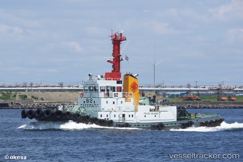
Take Maru No82
Current StatusWhere is the vessel?
Take Maru No82 is currently in Near NISHINOOMOTE, based on AIS data received about 14h ago.
Latest AIS update:
Current position: 30.73136° N, 130.88632° E (Near NISHINOOMOTE)
Average speed (last 7 days): Loading…
Average speed (last 30 days): Loading…
Vessel profile: Take Maru No82 is a Tug with dimensions 10m x 42m.
This page combines live AIS, route history, probable destination signals, nearby traffic, and port activity for practical vessel monitoring.
The current position of vessel Take Maru No82 is 30.73136 lat / 130.88632 lng. Updated: 2026-05-20 00:29:16 UTCNearest reference points:
- Near YAMAGAWA
- Near Kiire
- Near Kagoshima
Details:
Live Vessel Take Maru No82 Analytics (details, animations, etc.)
Recent AIS points (UTC):
2026-05-20 00:29:16 UTC · 30.73136, 130.88632 · SOG 3.2 kn · COG 32°2026-05-20 00:29:16 UTC · 30.73136, 130.88632 · SOG 3.2 kn · COG 32°
2026-05-20 00:29:16 UTC · 30.73136, 130.88632 · SOG 3.2 kn · COG 32°
2026-05-20 00:29:16 UTC · 30.73136, 130.88632 · SOG 3.2 kn · COG 32°