 IONIA
IONIA
Current Status
Where is the vessel?
IONIA is currently in 14 nm SW of Kastellorizou (ex Megísti), based on AIS data received about 14h ago.
Latest AIS update:
Current position: 36.00557° N, 29.38339° E (14 nm SW of Kastellorizou (ex Megísti))
Average speed (last 7 days): Loading…
Average speed (last 30 days): Loading…
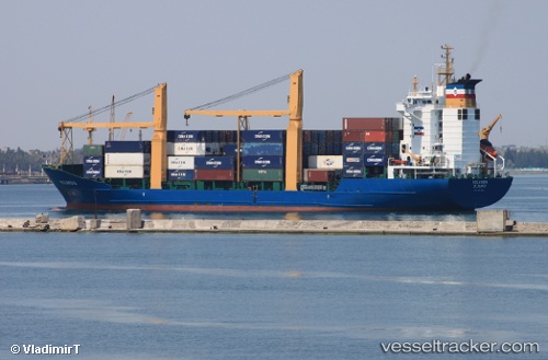
Vessel profile: IONIA is a Container Ship with dimensions m x m.
This page combines live AIS, route history, probable destination signals, nearby traffic, and port activity for practical vessel monitoring.
The current position of vessel IONIA is 36.00557 lat / 29.38339 lng. Updated: 2026-05-21 07:21:23 UTCNearest reference points:
- Near KAS
- Near Finike
- Near Fethiye
Details:
Live Vessel IONIA Analytics (details, animations, etc.)
Recent AIS points (UTC):
2026-05-21 02:51:04 UTC · 35.49167, 30.57667 · SOG 14 kn · COG -1°2026-05-21 04:36:36 UTC · 35.68583, 30.11390 · SOG 14.8 kn · COG 298°
2026-05-21 05:15:23 UTC · 35.75903, 29.94199 · SOG 14.4 kn · COG 300°
2026-05-21 07:21:23 UTC · 36.00557, 29.38339 · SOG 14.6 kn · COG 294°