 FORTUNE 9
Current Status
Where is the vessel?
FORTUNE 9 is currently in 71 nm NE of Colomadu, based on AIS data received about 15h ago.
Latest AIS update:
Current position: 8.56126° N, 111.33217° E (71 nm NE of Colomadu)
Average speed (last 7 days): Loading…
Average speed (last 30 days): Loading…
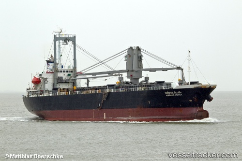
Vessel profile: FORTUNE 9 is a General Cargo with dimensions m x m.
This page combines live AIS, route history, probable destination signals, nearby traffic, and port activity for practical vessel monitoring.
The current position of vessel FORTUNE 9 is 8.56126 lat / 111.33217 lng. Updated: 2026-05-18 22:36:34 UTCNearest reference points:
- 156 nm SE of Phan Rang-Tháp Chàm
- 142 nm N of Pulau Lang Lang
- 141 nm N of Pulau Lang Lang
Currently sailing under the flag of Panama ![]()
Details:
Live Vessel FORTUNE 9 Analytics (details, animations, etc.)
Recent AIS points (UTC):
2026-05-18 19:31:04 UTC · 9.10568, 111.42671 · SOG 11 kn · COG 192°2026-05-18 21:49:14 UTC · 8.70114, 111.33635 · SOG 10 kn · COG 192°
2026-05-18 22:16:44 UTC · 8.61927, 111.33385 · SOG 10 kn · COG 181°
2026-05-18 22:36:34 UTC · 8.56126, 111.33217 · SOG 10 kn · COG 183°