 vesseltracker.com
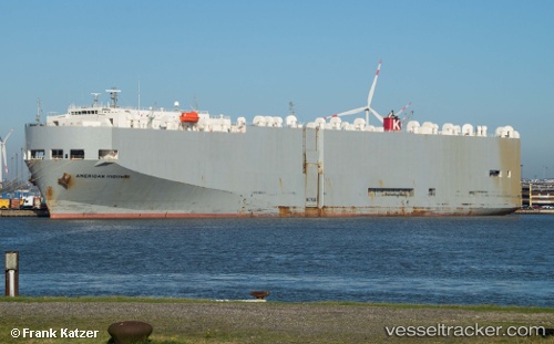
American Highway
Current StatusWhere is the vessel?
American Highway is currently in Near Jiddah, based on AIS data received about 14h ago.
Latest AIS update:
Current position: 21.46700° N, 39.16188° E (Near Jiddah)
Average speed (last 7 days): Loading…
Average speed (last 30 days): Loading…
Vessel profile: American Highway is a Vehicles Carrier with dimensions 32m x 180m.
This page combines live AIS, route history, probable destination signals, nearby traffic, and port activity for practical vessel monitoring.
The current position of vessel American Highway is 21.46700 lat / 39.16188 lng. Updated: 2026-05-18 07:50:10 UTCNearest reference points:
- Near Jeddah
- Near Tusdeer Free Zone
- 10 nm SW of Jeddah
Details:
Live Vessel American Highway Analytics (details, animations, etc.)
Recent AIS points (UTC):
2026-05-18 02:41:35 UTC · 18.78401, 38.00715 · SOG 12 kn · COG 285°2026-05-18 02:41:35 UTC · 18.78401, 38.00715 · SOG 12 kn · COG 285°
2026-05-18 07:14:12 UTC · 21.46700, 39.16188 · SOG 0 kn · COG 285°
2026-05-18 07:50:10 UTC · 21.46700, 39.16188 · SOG 0 kn · COG 285°