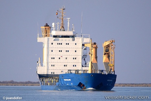
 MARANTA
Current Status
Where is the vessel?
MARANTA is currently in 98 nm N of Colomadu, based on AIS data received about 14h ago.
Latest AIS update:
Current position: 9.14029° N, 110.50287° E (98 nm N of Colomadu)
Average speed (last 7 days): Loading…
Average speed (last 30 days): Loading…
Vessel profile: MARANTA is a General Cargo with dimensions m x m.
This page combines live AIS, route history, probable destination signals, nearby traffic, and port activity for practical vessel monitoring.
The current position of vessel MARANTA is 9.14029 lat / 110.50287 lng. Updated: 2026-05-19 05:25:02 UTCNearest reference points:
- 156 nm SE of Phan Rang-Tháp Chàm
- Near Rang Dong
- 163 nm E of Vinh Cam Ranh
Currently sailing under the flag of Cameroon ![]()
Details:
Live Vessel MARANTA Analytics (details, animations, etc.)
Recent AIS points (UTC):
2026-05-18 21:16:20 UTC · 10.01279, 111.14387 · SOG 7 kn · COG 209°2026-05-19 03:34:35 UTC · 9.34059, 110.64673 · SOG 8.1 kn · COG 209°
2026-05-19 03:34:35 UTC · 9.34059, 110.64673 · SOG 8.1 kn · COG 209°
2026-05-19 05:25:02 UTC · 9.14029, 110.50287 · SOG 8.1 kn · COG 220°