 ANUNNAKI
Current Status
Where is the vessel?
ANUNNAKI is currently in 15 nm NW of Aseng FPSO, based on AIS data received about 14h ago.
Latest AIS update:
Current position: 3.57831° N, 8.99723° E (15 nm NW of Aseng FPSO)
Average speed (last 7 days): Loading…
Average speed (last 30 days): Loading…
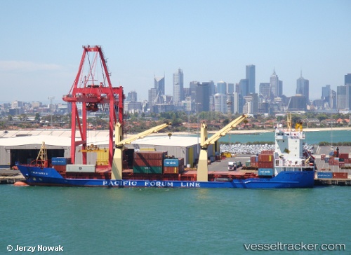
Vessel profile: ANUNNAKI is a General Cargo with dimensions m x m.
This page combines live AIS, route history, probable destination signals, nearby traffic, and port activity for practical vessel monitoring.
The current position of vessel ANUNNAKI is 3.57831 lat / 8.99723 lng. Updated: 2026-05-18 22:58:10 UTCNearest reference points:
- Near Victoria
- Near Moudi Terminal
- Near Odudu Terminal
Currently sailing under the flag of Sierra Leone ![]()
Details:
Live Vessel ANUNNAKI Analytics (details, animations, etc.)
Recent AIS points (UTC):
2026-05-18 19:10:59 UTC · 3.83117, 8.59084 · SOG 10.4 kn · COG 66°2026-05-18 20:23:21 UTC · 3.86500, 8.79544 · SOG 10.3 kn · COG 90°
2026-05-18 21:44:21 UTC · 3.78231, 8.99163 · SOG 10.1 kn · COG 140°
2026-05-18 22:58:10 UTC · 3.57831, 8.99723 · SOG 10.5 kn · COG 184°