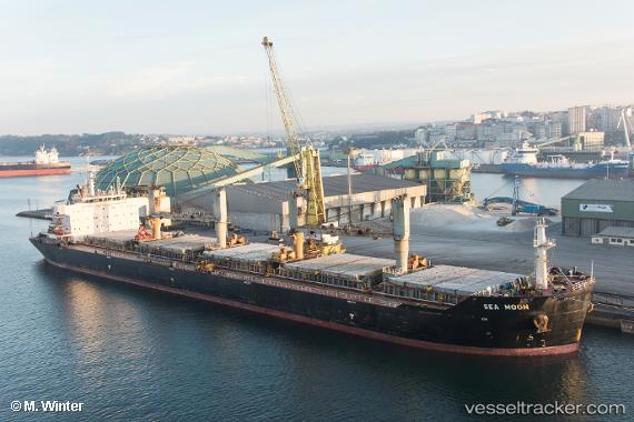
 SEA MOON
Current Status
Where is the vessel?
SEA MOON is currently in 11 nm N of RUMELI FENERI, based on AIS data received about 14h ago.
Latest AIS update:
Current position: 41.41033° N, 29.11959° E (11 nm N of RUMELI FENERI)
Average speed (last 7 days): Loading…
Average speed (last 30 days): Loading…
Vessel profile: SEA MOON is a Bulk Carrier with dimensions m x m.
This page combines live AIS, route history, probable destination signals, nearby traffic, and port activity for practical vessel monitoring.
The current position of vessel SEA MOON is 41.41033 lat / 29.11959 lng. Updated: 2026-05-19 14:23:37 UTCNearest reference points:
- Near RUMELI FENERI
- 19 nm NE of RUMELI FENERI
- Near Istinye/Istambul
Currently sailing under the flag of Greece ![]()
Details:
Live Vessel SEA MOON Analytics (details, animations, etc.)
Recent AIS points (UTC):
2026-05-19 09:45:55 UTC · 42.14544, 28.38873 · SOG 10.9 kn · COG 145°2026-05-19 12:00:26 UTC · 41.80101, 28.75866 · SOG 12.2 kn · COG 142°
2026-05-19 13:23:26 UTC · 41.58034, 28.99102 · SOG 12.1 kn · COG 146°
2026-05-19 14:23:37 UTC · 41.41033, 29.11959 · SOG 10.9 kn · COG 170°