 HOLSATIA
Current Status
Where is the vessel?
HOLSATIA is currently in 101 nm E of Phan Rang-Tháp Chàm, based on AIS data received about 16h ago.
Latest AIS update:
Current position: 10.91983° N, 110.57182° E (101 nm E of Phan Rang-Tháp Chàm)
Average speed (last 7 days): Loading…
Average speed (last 30 days): Loading…
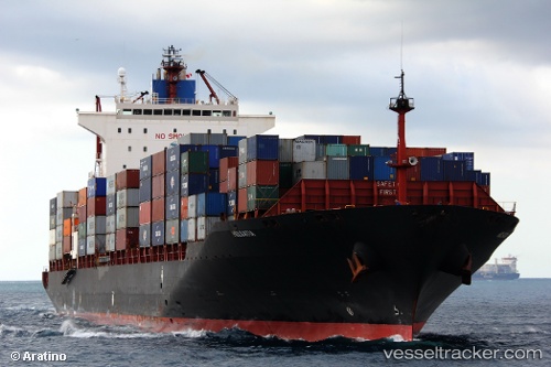
Vessel profile: HOLSATIA is a Container Ship with dimensions 32m x 260m.
This page combines live AIS, route history, probable destination signals, nearby traffic, and port activity for practical vessel monitoring.
The current position of vessel HOLSATIA is 10.91983 lat / 110.57182 lng. Updated: 2026-05-19 07:31:56 UTCNearest reference points:
- 156 nm SE of Phan Rang-Tháp Chàm
- 163 nm E of Vinh Cam Ranh
- Near Vinh Cam Ranh
Currently sailing under the flag of Liberia ![]()
HOLSATIA built in 2003 year
Deadweight:
50790 tDetails:
Live Vessel HOLSATIA Analytics (details, animations, etc.)
Recent AIS points (UTC):
2026-05-19 04:08:43 UTC · 9.91869, 110.14765 · SOG 18.7 kn · COG 13°2026-05-19 05:34:37 UTC · 10.34754, 110.29948 · SOG 19.7 kn · COG 21°
2026-05-19 07:23:19 UTC · 10.87606, 110.54827 · SOG 20.6 kn · COG 32°
2026-05-19 07:31:56 UTC · 10.91983, 110.57182 · SOG 20.6 kn · COG 32°