 Chie Maru
Current Status
Where is the vessel?
Chie Maru is currently in Near MIZUSHIMA, based on AIS data received about 14h ago.
Latest AIS update:
Current position: 34.43118° N, 133.71153° E (Near MIZUSHIMA)
Average speed (last 7 days): Loading…
Average speed (last 30 days): Loading…
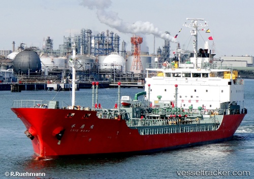
Vessel profile: Chie Maru is a Oil Products Tanker with dimensions 103m x 16m.
This page combines live AIS, route history, probable destination signals, nearby traffic, and port activity for practical vessel monitoring.
The current position of vessel Chie Maru is 34.43118 lat / 133.71153 lng. Updated: 2026-05-18 20:18:19 UTCNearest reference points:
- Near MIZUSHIMA
- Near Kurashiki
- Near Sakaide
Currently sailing under the flag of Japan ![]()
Details:
Live Vessel Chie Maru Analytics (details, animations, etc.)
Recent AIS points (UTC):
2026-05-18 17:09:17 UTC · 34.43174, 133.71227 · SOG 0 kn · COG 272°2026-05-18 17:54:18 UTC · 34.43182, 133.71225 · SOG 0 kn · COG 271°
2026-05-18 19:48:19 UTC · 34.43107, 133.71162 · SOG 0.1 kn · COG 333°
2026-05-18 20:18:19 UTC · 34.43118, 133.71153 · SOG 0 kn · COG 350°