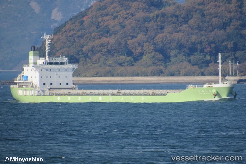
Shimanto
Current StatusWhere is the vessel?
Shimanto is currently in Near Hiroshima, based on AIS data received about 14h ago.
Latest AIS update:
Current position: 34.34042° N, 132.48540° E (Near Hiroshima)
Average speed (last 7 days): Loading…
Average speed (last 30 days): Loading…
Vessel profile: Shimanto is a Limestone Carrier with dimensions 20m x 150m.
This page combines live AIS, route history, probable destination signals, nearby traffic, and port activity for practical vessel monitoring.
The current position of vessel Shimanto is 34.34042 lat / 132.48540 lng. Updated: 2026-06-04 19:45:42 UTCNearest reference points:
- Near Hiroshima
- Near Kure
- Near TSUWAJI
Details:
Live Vessel Shimanto Analytics (details, animations, etc.)
Recent AIS points (UTC):
2026-06-04 17:00:47 UTC · 34.34041, 132.48540 · SOG 0 kn · COG -1°2026-06-04 18:30:45 UTC · 34.34042, 132.48541 · SOG 0 kn · COG -1°
2026-06-04 19:33:43 UTC · 34.34042, 132.48541 · SOG 0 kn · COG -1°
2026-06-04 19:45:42 UTC · 34.34042, 132.48540 · SOG 0 kn · COG -1°