 vesseltracker.com
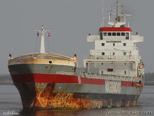
 Virginiaborg
Current Status
Where is the vessel?
Virginiaborg is currently in 43 nm NW of Nazaré, based on AIS data received about 14h ago.
Latest AIS update:
Current position: 40.00756° N, 9.82947° W (43 nm NW of Nazaré)
Average speed (last 7 days): Loading…
Average speed (last 30 days): Loading…
Vessel profile: Virginiaborg is a General Cargo Ship with dimensions 132m x 16m.
This page combines live AIS, route history, probable destination signals, nearby traffic, and port activity for practical vessel monitoring.
The current position of vessel Virginiaborg is 40.00756 lat / -9.82947 lng. Updated: 2026-05-18 09:38:31 UTCNearest reference points:
- 52 nm W of Canas de Santa Maria
- Near PENICHE
- Near Nazaré
Currently sailing under the flag of Netherlands ![]()
Virginiaborg built in 2001 year
Deadweight:
9600 tDetails:
Live Vessel Virginiaborg Analytics (details, animations, etc.)
Recent AIS points (UTC):
2026-05-18 06:18:09 UTC · 39.44469, -9.83775 · SOG 10.1 kn · COG 0°2026-05-18 08:16:31 UTC · 39.77621, -9.82900 · SOG 9.9 kn · COG 358°
2026-05-18 09:38:31 UTC · 40.00756, -9.82947 · SOG 10.2 kn · COG 358°
2026-05-18 09:38:31 UTC · 40.00756, -9.82947 · SOG 10.2 kn · COG 358°