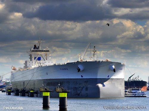
 SA EUROPE
Current Status
Where is the vessel?
SA EUROPE is currently in Near TANJUNG PELEPAS, based on AIS data received about 15h ago.
Latest AIS update:
Current position: 1.28075° N, 103.42653° E (Near TANJUNG PELEPAS)
Average speed (last 7 days): Loading…
Average speed (last 30 days): Loading…
Vessel profile: SA EUROPE is a Crude Oil Tanker with dimensions m x m.
This page combines live AIS, route history, probable destination signals, nearby traffic, and port activity for practical vessel monitoring.
The current position of vessel SA EUROPE is 1.28075 lat / 103.42653 lng. Updated: 2026-05-19 16:53:01 UTCNearest reference points:
- Near Tanjong Bin
- Near Nipah
- Near Tanjungbalai
Currently sailing under the flag of Bahamas ![]()
Details:
Live Vessel SA EUROPE Analytics (details, animations, etc.)
Recent AIS points (UTC):
2026-05-19 13:11:07 UTC · 1.28488, 103.42128 · SOG 0 kn · COG 117°2026-05-19 14:01:55 UTC · 1.28452, 103.42158 · SOG 0 kn · COG 115°
2026-05-19 15:28:58 UTC · 1.27963, 103.42355 · SOG 0.4 kn · COG 6°
2026-05-19 16:53:01 UTC · 1.28075, 103.42653 · SOG 0 kn · COG 306°