 vesseltracker.com
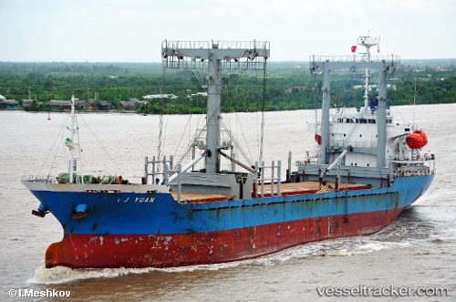
 NAFKRATIS
Current Status
Where is the vessel?
NAFKRATIS is currently in 24 nm N of SITIA, based on AIS data received about 15h ago.
Latest AIS update:
Current position: 35.57746° N, 25.93580° E (24 nm N of SITIA)
Average speed (last 7 days): Loading…
Average speed (last 30 days): Loading…
Vessel profile: NAFKRATIS is a General Cargo with dimensions m x m.
This page combines live AIS, route history, probable destination signals, nearby traffic, and port activity for practical vessel monitoring.
The current position of vessel NAFKRATIS is 35.57746 lat / 25.93580 lng. Updated: 2026-05-17 23:40:42 UTCNearest reference points:
- Near Iraklion
- 20 nm S of Astypálaia
- Near Kali Limenes
Currently sailing under the flag of Barbados ![]()
Details:
Live Vessel NAFKRATIS Analytics (details, animations, etc.)
Recent AIS points (UTC):
2026-05-17 19:33:42 UTC · 35.28484, 26.66434 · SOG 9.8 kn · COG 301°2026-05-17 21:55:51 UTC · 35.47024, 26.24857 · SOG 9.6 kn · COG 291°
2026-05-17 23:06:01 UTC · 35.54011, 26.03922 · SOG 9.4 kn · COG 293°
2026-05-17 23:40:42 UTC · 35.57746, 25.93580 · SOG 9.6 kn · COG 294°