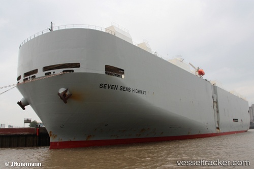
 Seven Seas Highway
Current Status
Where is the vessel?
Seven Seas Highway is currently in 44 nm S of Iwata, based on AIS data received about 14h ago.
Latest AIS update:
Current position: 33.96665° N, 137.76418° E (44 nm S of Iwata)
Average speed (last 7 days): Loading…
Average speed (last 30 days): Loading…
Vessel profile: Seven Seas Highway is a Vehicles Carrier with dimensions 200m x 200m.
This page combines live AIS, route history, probable destination signals, nearby traffic, and port activity for practical vessel monitoring.
The current position of vessel Seven Seas Highway is 33.96665 lat / 137.76418 lng. Updated: 2026-05-19 15:58:26 UTCNearest reference points:
- 17 nm SW of OMAEZAKI
- 17 nm S of TOYOHASHI
- 12 nm E of TOBA
Currently sailing under the flag of Panama ![]()
Seven Seas Highway built in 2001 year
Deadweight:
17232 tDetails:
Live Vessel Seven Seas Highway Analytics (details, animations, etc.)
Recent AIS points (UTC):
2026-05-19 13:03:25 UTC · 33.97156, 137.83234 · SOG 0.9 kn · COG 292°2026-05-19 14:18:45 UTC · 33.96286, 137.80516 · SOG 1.2 kn · COG 292°
2026-05-19 15:58:26 UTC · 33.96665, 137.76418 · SOG 1.2 kn · COG 312°
2026-05-19 15:58:26 UTC · 33.96665, 137.76418 · SOG 1.2 kn · COG 312°