 HI 03
HI 03
Current Status
Where is the vessel?
HI 03 is currently in Near TANJUNG PEMANCINGAN, based on AIS data received about 15h ago.
Latest AIS update:
Current position: 3.22285° S, 116.32660° E (Near TANJUNG PEMANCINGAN)
Average speed (last 7 days): Loading…
Average speed (last 30 days): Loading…
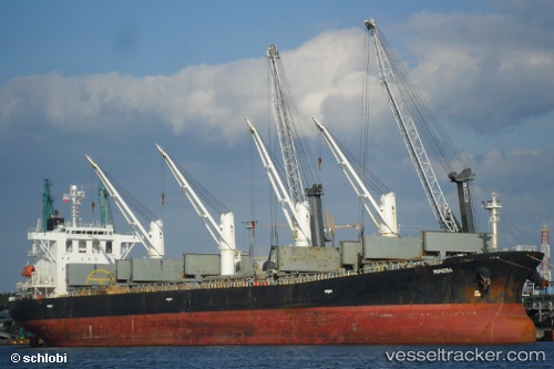
Vessel profile: HI 03 is a Bulk Carrier with dimensions 32m x 190m.
This page combines live AIS, route history, probable destination signals, nearby traffic, and port activity for practical vessel monitoring.
The current position of vessel HI 03 is -3.22285 lat / 116.32660 lng. Updated: 2026-05-20 22:21:27 UTCNearest reference points:
- Near TANJUNG PEMANCINGAN
- 12 nm SE of Bunati
- Near Bunati
Currently sailing under the flag of Indonesia ![]()
HI 03 built in 2002 year
Deadweight:
52479 tDetails:
Live Vessel HI 03 Analytics (details, animations, etc.)
Recent AIS points (UTC):
2026-05-20 15:03:35 UTC · -3.22332, 116.32727 · SOG 0.1 kn · COG 23°2026-05-20 18:24:30 UTC · -3.22253, 116.32647 · SOG 0 kn · COG 68°
2026-05-20 21:21:30 UTC · -3.22222, 116.32633 · SOG 0 kn · COG 79°
2026-05-20 22:21:27 UTC · -3.22285, 116.32660 · SOG 0 kn · COG 54°