 vesseltracker.com
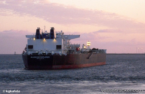
 Alaskan Explorer
Current Status
Where is the vessel?
Alaskan Explorer is currently in Near Ocean View, based on AIS data received about 14h ago.
Latest AIS update:
Current position: 38.95088° N, 75.17921° W (Near Ocean View)
Average speed (last 7 days): Loading…
Average speed (last 30 days): Loading…
Vessel profile: Alaskan Explorer is a Crude Oil Tanker with dimensions 287m x 50m.
This page combines live AIS, route history, probable destination signals, nearby traffic, and port activity for practical vessel monitoring.
The current position of vessel Alaskan Explorer is 38.95088 lat / -75.17921 lng. Updated: 2026-05-18 13:44:09 UTCNearest reference points:
- Near Slaughter Beach
- Near Corbin City
- Near Wilmington
Currently sailing under the flag of USA ![]()
Details:
Live Vessel Alaskan Explorer Analytics (details, animations, etc.)
Recent AIS points (UTC):
2026-05-18 11:08:16 UTC · 38.95032, -75.17779 · SOG 0 kn · COG 140°2026-05-18 12:02:09 UTC · 38.95096, -75.17793 · SOG 0.1 kn · COG 158°
2026-05-18 13:23:09 UTC · 38.95081, -75.17933 · SOG 0.1 kn · COG 155°
2026-05-18 13:44:09 UTC · 38.95088, -75.17921 · SOG 0.1 kn · COG 158°