 vesseltracker.com
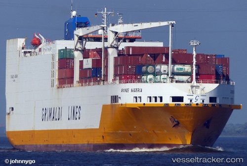
Grande Nigeria
Current StatusWhere is the vessel?
Grande Nigeria is currently in 89 nm S of PASITO BLANCO, based on AIS data received about 14h ago.
Latest AIS update:
Current position: 26.25899° N, 15.71354° W (89 nm S of PASITO BLANCO)
Average speed (last 7 days): Loading…
Average speed (last 30 days): Loading…
Vessel profile: Grande Nigeria is a Vehicles Carrier with dimensions 32m x 214m.
This page combines live AIS, route history, probable destination signals, nearby traffic, and port activity for practical vessel monitoring.
The current position of vessel Grande Nigeria is 26.25899 lat / -15.71354 lng. Updated: 2026-05-18 13:48:20 UTCNearest reference points:
- 33 nm SE of San Agustin
- 22 nm S of San Agustin
- Near San Nicolás
Details:
Live Vessel Grande Nigeria Analytics (details, animations, etc.)
Recent AIS points (UTC):
2026-05-18 10:08:58 UTC · 26.95482, -14.92292 · SOG 16 kn · COG 227°2026-05-18 11:23:14 UTC · 26.72484, -15.19059 · SOG 16.2 kn · COG 222°
2026-05-18 13:48:20 UTC · 26.25899, -15.71354 · SOG 16.3 kn · COG 227°
2026-05-18 13:48:20 UTC · 26.25899, -15.71354 · SOG 16.3 kn · COG 227°