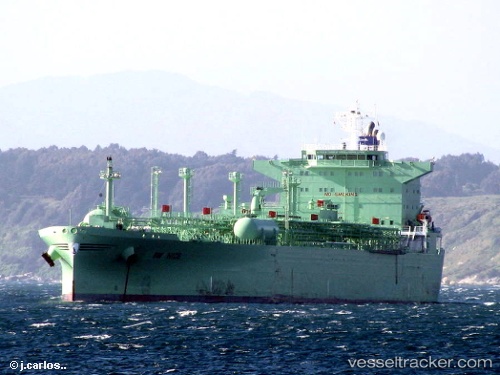
 NICE
NICE
Current Status
Where is the vessel?
NICE is currently in 101 nm S of Grand Cayman, based on AIS data received about 2d ago.
Latest AIS update:
Current position: 17.60766° N, 81.13186° W (101 nm S of Grand Cayman)
Average speed (last 7 days): Loading…
Average speed (last 30 days): Loading…
Vessel profile: NICE is a LPG Tanker with dimensions 32m x 205m.
This page combines live AIS, route history, probable destination signals, nearby traffic, and port activity for practical vessel monitoring.
The current position of vessel NICE is 17.60766 lat / -81.13186 lng. Updated: 2026-05-19 15:57:25 UTCNearest reference points:
- Near Georgetown, Grand Cayman
Currently sailing under the flag of Norway (NIS) ![]()
NICE built in 2003 year
Deadweight:
44639 tDetails:
Live Vessel NICE Analytics (details, animations, etc.)
Recent AIS points (UTC):
2026-05-19 15:57:25 UTC · 17.60766, -81.13186 · SOG 11.9 kn · COG -1°2026-05-19 15:57:25 UTC · 17.60766, -81.13186 · SOG 11.9 kn · COG -1°
2026-05-19 15:57:25 UTC · 17.60766, -81.13186 · SOG 11.9 kn · COG -1°
2026-05-19 15:57:25 UTC · 17.60766, -81.13186 · SOG 11.9 kn · COG -1°