 vesseltracker.com
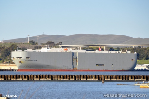
 Mediterraneanhighway
Current Status
Where is the vessel?
Mediterraneanhighway is currently in 76 nm NE of Suqutrá, based on AIS data received about 2d ago.
Latest AIS update:
Current position: 13.58975° N, 54.66875° E (76 nm NE of Suqutrá)
Average speed (last 7 days): Loading…
Average speed (last 30 days): Loading…
Vessel profile: Mediterraneanhighway is a Vehicles Carrier with dimensions 200m x 32m.
This page combines live AIS, route history, probable destination signals, nearby traffic, and port activity for practical vessel monitoring.
The current position of vessel Mediterraneanhighway is 13.58975 lat / 54.66875 lng. Updated: 2026-05-15 11:11:58 UTCNearest reference points:
- 103 nm S of Port Raysut
- 110 nm NE of Gross Koris
- 106 nm S of Port Raysut
Currently sailing under the flag of Panama ![]()
Mediterraneanhighway built in 2002 year
Deadweight:
17228 tDetails:
Live Vessel Mediterraneanhighway Analytics (details, animations, etc.)
Recent AIS points (UTC):
2026-05-15 11:11:58 UTC · 13.58975, 54.66875 · SOG 15.6 kn · COG 268°2026-05-15 11:11:58 UTC · 13.58975, 54.66875 · SOG 15.6 kn · COG 268°
2026-05-15 11:11:58 UTC · 13.58975, 54.66875 · SOG 15.6 kn · COG 268°
2026-05-15 11:11:58 UTC · 13.58975, 54.66875 · SOG 15.6 kn · COG 268°