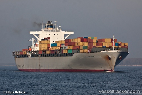
Ikaria
Current StatusWhere is the vessel?
Ikaria is currently in Near Tamatave, based on AIS data received about 15h ago.
Latest AIS update:
Current position: 18.14795° S, 49.42903° E (Near Tamatave)
Average speed (last 7 days): Loading…
Average speed (last 30 days): Loading…
Vessel profile: Ikaria is a Container Ship with dimensions 40m x 279m.
This page combines live AIS, route history, probable destination signals, nearby traffic, and port activity for practical vessel monitoring.
The current position of vessel Ikaria is -18.14795 lat / 49.42903 lng. Updated: 2026-05-21 19:03:04 UTCDetails:
Live Vessel Ikaria Analytics (details, animations, etc.)
Recent AIS points (UTC):
2026-05-21 15:25:01 UTC · -18.14791, 49.42905 · SOG 0 kn · COG 205°2026-05-21 16:00:04 UTC · -18.14794, 49.42900 · SOG 0 kn · COG 205°
2026-05-21 17:36:05 UTC · -18.14790, 49.42900 · SOG 0 kn · COG 206°
2026-05-21 19:03:04 UTC · -18.14795, 49.42903 · SOG 0 kn · COG 205°