 Lng Enugu
Current Status
Where is the vessel?
Lng Enugu is currently in 50 nm N of Krueng Geukueh, based on AIS data received about 14h ago.
Latest AIS update:
Current position: 6.02484° N, 96.71486° E (50 nm N of Krueng Geukueh)
Average speed (last 7 days): Loading…
Average speed (last 30 days): Loading…
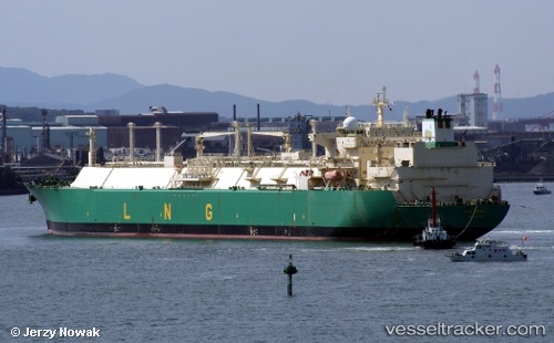
Vessel profile: Lng Enugu is a Lng Tanker with dimensions 285m x 43m.
This page combines live AIS, route history, probable destination signals, nearby traffic, and port activity for practical vessel monitoring.
The current position of vessel Lng Enugu is 6.02484 lat / 96.71486 lng. Updated: 2026-05-19 11:49:53 UTCNearest reference points:
- 45 nm NE of Krueng Geukueh
- 34 nm N of Langsa Venture FPSO
- 53 nm NE of Sebang
Currently sailing under the flag of Bermuda ![]()
Lng Enugu built in 2005 year
Deadweight:
83160 tDetails:
Live Vessel Lng Enugu Analytics (details, animations, etc.)
Recent AIS points (UTC):
2026-05-19 08:11:13 UTC · 6.19927, 96.03249 · SOG 11.5 kn · COG 103°2026-05-19 09:54:34 UTC · 6.12975, 96.36509 · SOG 11.4 kn · COG 103°
2026-05-19 10:33:33 UTC · 6.10610, 96.48655 · SOG 11 kn · COG 145°
2026-05-19 11:49:53 UTC · 6.02484, 96.71486 · SOG 11.6 kn · COG 101°