 STARBOUND EXPLORER
Current Status
Where is the vessel?
STARBOUND EXPLORER is currently in 33 nm W of AMERI, based on AIS data received about 15h ago.
Latest AIS update:
Current position: 28.41037° N, 50.47309° E (33 nm W of AMERI)
Average speed (last 7 days): Loading…
Average speed (last 30 days): Loading…
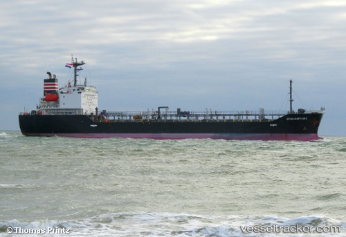
Vessel profile: STARBOUND EXPLORER is a Oil/Chemical Tanker with dimensions m x m.
This page combines live AIS, route history, probable destination signals, nearby traffic, and port activity for practical vessel monitoring.
The current position of vessel STARBOUND EXPLORER is 28.41037 lat / 50.47309 lng. Updated: 2026-05-18 19:44:36 UTCNearest reference points:
- Near Bushehr
- 44 nm NE of Ras Al Khair
- 41 nm S of Soroosh (Cyrus) Terminal
Currently sailing under the flag of Madagascar ![]()
Details:
Live Vessel STARBOUND EXPLORER Analytics (details, animations, etc.)
Recent AIS points (UTC):
2026-05-18 16:52:16 UTC · 28.09580, 50.88572 · SOG 10.9 kn · COG 308°2026-05-18 17:45:25 UTC · 28.18769, 50.75492 · SOG 10.9 kn · COG 308°
2026-05-18 19:33:45 UTC · 28.38708, 50.49656 · SOG 11.3 kn · COG 318°
2026-05-18 19:44:36 UTC · 28.41037, 50.47309 · SOG 11.3 kn · COG 318°