 vesseltracker.com
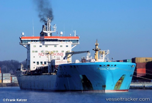
 TONDA
TONDA
Current Status
Where is the vessel?
TONDA is currently in 53 nm NE of Gross Koris, based on AIS data received about 14h ago.
Latest AIS update:
Current position: 14.34975° N, 52.75570° E (53 nm NE of Gross Koris)
Average speed (last 7 days): Loading…
Average speed (last 30 days): Loading…
Vessel profile: TONDA is a Chemical/Oil Products Tanker with dimensions 186m x 186m.
This page combines live AIS, route history, probable destination signals, nearby traffic, and port activity for practical vessel monitoring.
The current position of vessel TONDA is 14.34975 lat / 52.75570 lng. Updated: 2026-05-18 06:07:13 UTCNearest reference points:
- 110 nm NE of Gross Koris
- 106 nm S of Port Raysut
- 103 nm S of Port Raysut
Currently sailing under the flag of Marshall Islands ![]()
TONDA built in 2005 year
Deadweight:
36803 tDetails:
Live Vessel TONDA Analytics (details, animations, etc.)
Recent AIS points (UTC):
2026-05-18 01:52:06 UTC · 14.33056, 53.52985 · SOG 11.8 kn · COG 281°2026-05-18 04:35:03 UTC · 14.42778, 53.01992 · SOG 10.2 kn · COG 256°
2026-05-18 05:40:52 UTC · 14.37150, 52.83473 · SOG 10.7 kn · COG 251°
2026-05-18 06:07:13 UTC · 14.34975, 52.75570 · SOG 10.8 kn · COG 261°