 vesseltracker.com
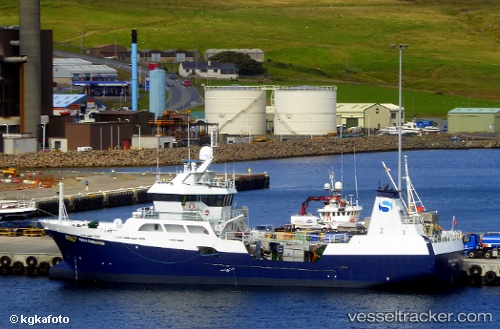
 Ronja Commander
Current Status
Where is the vessel?
Ronja Commander is currently in Near MALLAIG, based on AIS data received about 1h ago.
Latest AIS update:
Current position: 57.00742° N, 5.82736° W (Near MALLAIG)
Average speed (last 7 days): Loading…
Average speed (last 30 days): Loading…
Vessel profile: Ronja Commander is a Fish Carrier with dimensions 55m x 55m.
This page combines live AIS, route history, probable destination signals, nearby traffic, and port activity for practical vessel monitoring.
The current position of vessel Ronja Commander is 57.00742 lat / -5.82736 lng. Updated: 2026-05-17 17:43:48 UTCNearest reference points:
- Near KYLE OF LOCHALSH
- Near Fishnish, Isle of Mull
- Near CRAIGNURE PIER
Currently sailing under the flag of Norway ![]()
Details:
Live Vessel Ronja Commander Analytics (details, animations, etc.)
Recent AIS points (UTC):
2026-05-17 14:06:58 UTC · 57.00739, -5.82733 · SOG 0 kn · COG 67°2026-05-17 16:08:59 UTC · 57.00739, -5.82730 · SOG 0 kn · COG 68°
2026-05-17 16:22:37 UTC · 57.00739, -5.82726 · SOG 0 kn · COG 69°
2026-05-17 17:43:48 UTC · 57.00742, -5.82736 · SOG 0 kn · COG 68°