St Ilhaam
Current StatusWhere is the vessel?
St Ilhaam is currently in 19 nm S of Ketu, based on AIS data received about 15h ago.
Latest AIS update:
Current position: 6.32833° N, 3.97333° E (19 nm S of Ketu)
Average speed (last 7 days): Loading…
Average speed (last 30 days): Loading…
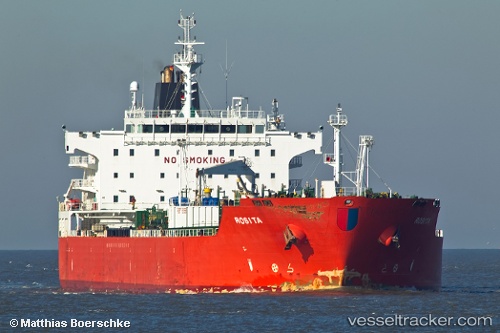
Vessel profile: St Ilhaam is a Chemical Oil Products Tanker with dimensions 32m x 180m.
This page combines live AIS, route history, probable destination signals, nearby traffic, and port activity for practical vessel monitoring.
The current position of vessel St Ilhaam is 6.32833 lat / 3.97333 lng. Updated: 2026-05-20 13:49:50 UTCNearest reference points:
- Near Lagos
- Near Apapa
- Near Kirikiri
Details:
Live Vessel St Ilhaam Analytics (details, animations, etc.)
Recent AIS points (UTC):
2026-05-20 10:27:41 UTC · 6.32833, 3.97333 · SOG 0 kn · COG -1°2026-05-20 11:49:07 UTC · 6.32833, 3.97333 · SOG 0 kn · COG -1°
2026-05-20 13:25:40 UTC · 6.32833, 3.97333 · SOG 0 kn · COG -1°
2026-05-20 13:49:50 UTC · 6.32833, 3.97333 · SOG 0 kn · COG -1°