 vesseltracker.com
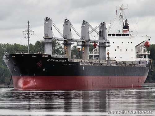
 DREAM
DREAM
Current Status
Where is the vessel?
DREAM is currently in Near Mersin, based on AIS data received about 14h ago.
Latest AIS update:
Current position: 36.70293° N, 34.60677° E (Near Mersin)
Average speed (last 7 days): Loading…
Average speed (last 30 days): Loading…
Vessel profile: DREAM is a Bulk Carrier with dimensions m x m.
This page combines live AIS, route history, probable destination signals, nearby traffic, and port activity for practical vessel monitoring.
The current position of vessel DREAM is 36.70293 lat / 34.60677 lng. Updated: 2026-05-18 07:49:42 UTCNearest reference points:
- Near Mersin
- Near Mersin-Free Zone
- Near YUMURTALIC
Currently sailing under the flag of Saint Kitts and Nevis ![]()
Details:
Live Vessel DREAM Analytics (details, animations, etc.)
Recent AIS points (UTC):
2026-05-18 04:10:42 UTC · 36.70522, 34.60592 · SOG 0 kn · COG 127°2026-05-18 05:55:41 UTC · 36.70553, 34.60623 · SOG 0 kn · COG 144°
2026-05-18 07:13:40 UTC · 36.70322, 34.60617 · SOG 0 kn · COG 49°
2026-05-18 07:49:42 UTC · 36.70293, 34.60677 · SOG 0 kn · COG 26°