 vesseltracker.com
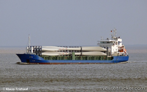
 LUCA
LUCA
Current Status
Where is the vessel?
LUCA is currently in 11 nm NE of Sosnovyy Bor, based on AIS data received about 23h ago.
Latest AIS update:
Current position: 60.01608° N, 29.32680° E (11 nm NE of Sosnovyy Bor)
Average speed (last 7 days): Loading…
Average speed (last 30 days): Loading…
Vessel profile: LUCA is a General Cargo Ship with dimensions 101m x 180m.
This page combines live AIS, route history, probable destination signals, nearby traffic, and port activity for practical vessel monitoring.
The current position of vessel LUCA is 60.01608 lat / 29.32680 lng. Updated: 2026-05-17 17:19:47 UTCNearest reference points:
- 14 nm NW of KRONSHTADT
- Near Kronstadt
- Near KRONSHTADT
Currently sailing under the flag of Antigua and Barbuda ![]()
LUCA built in 2004 year
Deadweight:
4815 tDetails:
Live Vessel LUCA Analytics (details, animations, etc.)
Recent AIS points (UTC):
2026-05-17 17:19:47 UTC · 60.01608, 29.32680 · SOG 4.6 kn · COG 285°2026-05-17 17:19:47 UTC · 60.01608, 29.32680 · SOG 4.6 kn · COG 285°
2026-05-17 17:19:47 UTC · 60.01608, 29.32680 · SOG 4.6 kn · COG 285°
2026-05-17 17:19:47 UTC · 60.01608, 29.32680 · SOG 4.6 kn · COG 285°