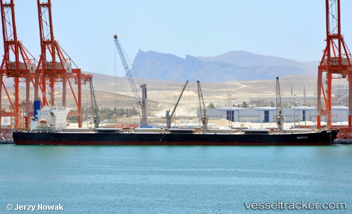
Peony Laut
Current StatusWhere is the vessel?
Peony Laut is currently in Near Taboneo, based on AIS data received about 14h ago.
Latest AIS update:
Current position: 3.74795° S, 114.45875° E (Near Taboneo)
Average speed (last 7 days): Loading…
Average speed (last 30 days): Loading…
Vessel profile: Peony Laut is a Bulk Carrier with dimensions 32m x 225m.
This page combines live AIS, route history, probable destination signals, nearby traffic, and port activity for practical vessel monitoring.
The current position of vessel Peony Laut is -3.74795 lat / 114.45875 lng. Updated: 2026-05-21 16:08:41 UTCNearest reference points:
- Near Taboneo
- Near BANJARMASIN
- Near Bunati
Details:
Live Vessel Peony Laut Analytics (details, animations, etc.)
Recent AIS points (UTC):
2026-05-21 13:32:43 UTC · -3.74775, 114.45892 · SOG 0 kn · COG 137°2026-05-21 13:50:41 UTC · -3.74785, 114.45878 · SOG 0 kn · COG 135°
2026-05-21 16:05:41 UTC · -3.74795, 114.45872 · SOG 0 kn · COG 127°
2026-05-21 16:08:41 UTC · -3.74795, 114.45875 · SOG 0 kn · COG 126°