 vesseltracker.com
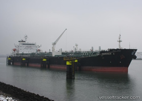
 Mariner A
Current Status
Where is the vessel?
Mariner A is currently in Near Bonny, based on AIS data received about 14h ago.
Latest AIS update:
Current position: 4.46333° N, 7.16104° E (Near Bonny)
Average speed (last 7 days): Loading…
Average speed (last 30 days): Loading…
Vessel profile: Mariner A is a Chemical Oil Products Tanker with dimensions 176m x 31m.
This page combines live AIS, route history, probable destination signals, nearby traffic, and port activity for practical vessel monitoring.
The current position of vessel Mariner A is 4.46333 lat / 7.16104 lng. Updated: 2026-05-18 05:34:27 UTCNearest reference points:
- Near Bonny
- Near Onne
- Near Ima
Currently sailing under the flag of Malta ![]()
Mariner A built in 2005 year
Deadweight:
40099 tDetails:
Live Vessel Mariner A Analytics (details, animations, etc.)
Recent AIS points (UTC):
2026-05-18 02:16:29 UTC · 4.46340, 7.16054 · SOG 0.1 kn · COG 218°2026-05-18 03:37:04 UTC · 4.46337, 7.16055 · SOG 0 kn · COG 222°
2026-05-18 04:46:03 UTC · 4.46367, 7.16040 · SOG 0.3 kn · COG 207°
2026-05-18 05:34:27 UTC · 4.46333, 7.16104 · SOG 0.1 kn · COG 237°