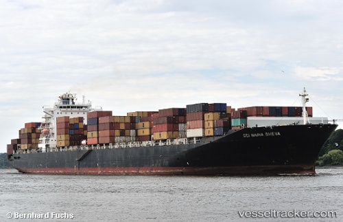
 OOCL ST.LAWRENCE
Current Status
Where is the vessel?
OOCL ST.LAWRENCE is currently in 90 nm NE of La Cruz de Illas, based on AIS data received about 15h ago.
Latest AIS update:
Current position: 44.76500° N, 53.91167° W (90 nm NE of La Cruz de Illas)
Average speed (last 7 days): Loading…
Average speed (last 30 days): Loading…
Vessel profile: OOCL ST.LAWRENCE is a Container Ship with dimensions m x m.
This page combines live AIS, route history, probable destination signals, nearby traffic, and port activity for practical vessel monitoring.
The current position of vessel OOCL ST.LAWRENCE is 44.76500 lat / -53.91167 lng. Updated: 2026-05-21 01:59:13 UTCNearest reference points:
- 49 nm NW of La Cruz de Illas
- 28 nm NE of Valencia de San Juan
- Near SAINT PIERRE
Currently sailing under the flag of Marshall Islands ![]()
Details:
Live Vessel OOCL ST.LAWRENCE Analytics (details, animations, etc.)
Recent AIS points (UTC):
2026-05-20 23:08:15 UTC · 44.41000, -53.18667 · SOG 13 kn · COG -1°2026-05-20 23:29:15 UTC · 44.45333, -53.27667 · SOG 13 kn · COG -1°
2026-05-21 01:59:13 UTC · 44.76500, -53.91167 · SOG 13 kn · COG -1°
2026-05-21 01:59:13 UTC · 44.76500, -53.91167 · SOG 13 kn · COG -1°