 vesseltracker.com
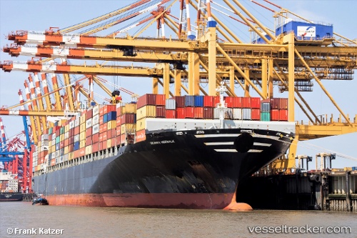
 NORWALK
Current Status
Where is the vessel?
NORWALK is currently in 51 nm NW of Caufield North, based on AIS data received about 14h ago.
Latest AIS update:
Current position: 37.11937° S, 14.36147° E (51 nm NW of Caufield North)
Average speed (last 7 days): Loading…
Average speed (last 30 days): Loading…
Vessel profile: NORWALK is a Container Ship with dimensions m x m.
This page combines live AIS, route history, probable destination signals, nearby traffic, and port activity for practical vessel monitoring.
The current position of vessel NORWALK is -37.11937 lat / 14.36147 lng. Updated: 2026-05-18 11:49:03 UTCCurrently sailing under the flag of Liberia ![]()
Details:
Live Vessel NORWALK Analytics (details, animations, etc.)
Recent AIS points (UTC):
2026-05-18 07:47:35 UTC · -37.08833, 13.33500 · SOG 11 kn · COG -1°2026-05-18 09:44:52 UTC · -37.10542, 13.82522 · SOG 11.8 kn · COG 100°
2026-05-18 10:48:13 UTC · -37.11386, 14.09375 · SOG 12.4 kn · COG 93°
2026-05-18 11:49:03 UTC · -37.11937, 14.36147 · SOG 12.9 kn · COG 92°