 AMO
AMO
Current Status
Where is the vessel?
AMO is currently in 246 nm W of Tinaquillo, based on AIS data received about 17h ago.
Latest AIS update:
Current position: 9.57737° N, 64.14930° E (246 nm W of Tinaquillo)
Average speed (last 7 days): Loading…
Average speed (last 30 days): Loading…
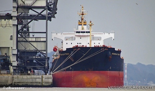
Vessel profile: AMO is a Bulk Carrier with dimensions m x m.
This page combines live AIS, route history, probable destination signals, nearby traffic, and port activity for practical vessel monitoring.
The current position of vessel AMO is 9.57737 lat / 64.14930 lng. Updated: 2026-05-19 03:17:09 UTCNearest reference points:
- Open sea, approx. 400 nm off the nearest listed port
- Open sea, approx. 402 nm off the nearest listed port
- Open sea, approx. 407 nm off the nearest listed port
Currently sailing under the flag of Marshall Islands ![]()
Details:
Live Vessel AMO Analytics (details, animations, etc.)
Recent AIS points (UTC):
2026-05-19 00:31:16 UTC · 9.29015, 63.86938 · SOG 8.3 kn · COG 43°2026-05-19 03:17:09 UTC · 9.57737, 64.14930 · SOG 8.9 kn · COG 42°
2026-05-19 03:17:09 UTC · 9.57737, 64.14930 · SOG 8.9 kn · COG 42°
2026-05-19 03:17:09 UTC · 9.57737, 64.14930 · SOG 8.9 kn · COG 42°