 BOUBOULINA
Current Status
Where is the vessel?
BOUBOULINA is currently in 52 nm NE of PENGERANG, based on AIS data received about 14h ago.
Latest AIS update:
Current position: 1.93047° N, 104.79110° E (52 nm NE of PENGERANG)
Average speed (last 7 days): Loading…
Average speed (last 30 days): Loading…
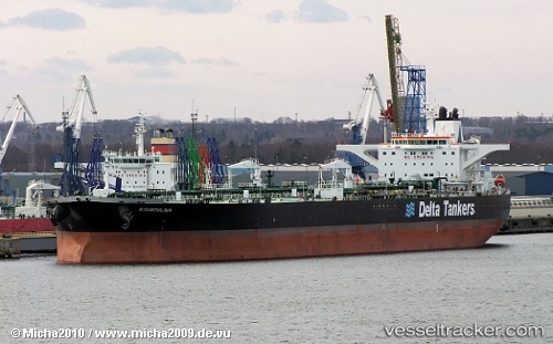
Vessel profile: BOUBOULINA is a Crude Oil Tanker with dimensions m x m.
This page combines live AIS, route history, probable destination signals, nearby traffic, and port activity for practical vessel monitoring.
The current position of vessel BOUBOULINA is 1.93047 lat / 104.79110 lng. Updated: 2026-05-19 04:06:54 UTCNearest reference points:
- 51 nm NE of PENGERANG
- 53 nm NE of PENGERANG
- 55 nm NE of PENGERANG
Currently sailing under the flag of Liberia ![]()
Details:
Live Vessel BOUBOULINA Analytics (details, animations, etc.)
Recent AIS points (UTC):
2026-05-19 02:03:54 UTC · 1.93223, 104.78887 · SOG 0.1 kn · COG 78°2026-05-19 02:11:28 UTC · 1.93202, 104.78890 · SOG 0.2 kn · COG -1°
2026-05-19 03:36:54 UTC · 1.93053, 104.79043 · SOG 0.2 kn · COG 22°
2026-05-19 04:06:54 UTC · 1.93047, 104.79110 · SOG 0 kn · COG 3°