 vesseltracker.com
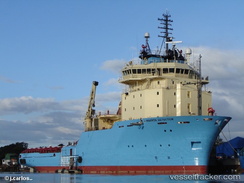
 DETECTOR
Current Status
Where is the vessel?
DETECTOR is currently in Near TERSCHELLING, based on AIS data received about 14h ago.
Latest AIS update:
Current position: 53.45969° N, 5.16167° E (Near TERSCHELLING)
Average speed (last 7 days): Loading…
Average speed (last 30 days): Loading…
Vessel profile: DETECTOR is a Anchor Handling Vessel with dimensions m x m.
This page combines live AIS, route history, probable destination signals, nearby traffic, and port activity for practical vessel monitoring.
The current position of vessel DETECTOR is 53.45969 lat / 5.16167 lng. Updated: 2026-05-18 07:51:09 UTCNearest reference points:
- Near HARLINGEN
- Near FRANEKER
- Near Wonseradeel/Makkum
Currently sailing under the flag of Denmark ![]()
Details:
Live Vessel DETECTOR Analytics (details, animations, etc.)
Recent AIS points (UTC):
2026-05-18 04:49:10 UTC · 53.65357, 5.25719 · SOG 4.9 kn · COG 189°2026-05-18 05:33:30 UTC · 53.59294, 5.27124 · SOG 4.9 kn · COG 187°
2026-05-18 07:38:49 UTC · 53.46672, 5.18340 · SOG 4.2 kn · COG 243°
2026-05-18 07:51:09 UTC · 53.45969, 5.16167 · SOG 4.3 kn · COG 245°