 VIREL
VIREL
Current Status
Where is the vessel?
VIREL is currently in 42 nm S of Olhão, based on AIS data received about 15h ago.
Latest AIS update:
Current position: 36.34859° N, 7.61325° W (42 nm S of Olhão)
Average speed (last 7 days): Loading…
Average speed (last 30 days): Loading…
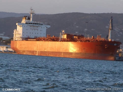
Vessel profile: VIREL is a Oil/Chemical Tanker with dimensions m x m.
This page combines live AIS, route history, probable destination signals, nearby traffic, and port activity for practical vessel monitoring.
The current position of vessel VIREL is 36.34859 lat / -7.61325 lng. Updated: 2026-05-18 17:58:13 UTCNearest reference points:
- 42 nm S of Faro
- 45 nm W of Gibraltar
- Near Olhão
Currently sailing under the flag of Cameroon ![]()
Details:
Live Vessel VIREL Analytics (details, animations, etc.)
Recent AIS points (UTC):
2026-05-18 14:01:13 UTC · 36.11400, -6.71817 · SOG 11.5 kn · COG 300°2026-05-18 16:22:13 UTC · 36.26455, -7.25279 · SOG 11.5 kn · COG 288°
2026-05-18 16:25:55 UTC · 36.26810, -7.26663 · SOG 11.5 kn · COG 288°
2026-05-18 17:58:13 UTC · 36.34859, -7.61325 · SOG 11.5 kn · COG 288°