 vesseltracker.com
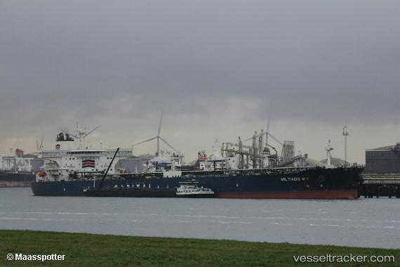
 TORX
TORX
Current Status
Where is the vessel?
TORX is currently in Near Sarköy, based on AIS data received about 15h ago.
Latest AIS update:
Current position: 40.60943° N, 27.16323° E (Near Sarköy)
Average speed (last 7 days): Loading…
Average speed (last 30 days): Loading…
Vessel profile: TORX is a Crude Oil Tanker with dimensions m x m.
This page combines live AIS, route history, probable destination signals, nearby traffic, and port activity for practical vessel monitoring.
The current position of vessel TORX is 40.60943 lat / 27.16323 lng. Updated: 2026-05-17 23:35:48 UTCNearest reference points:
- Near Sarköy
- Near Marmara Adasi
- Near Saraylar
Currently sailing under the flag of Panama ![]()
Details:
Live Vessel TORX Analytics (details, animations, etc.)
Recent AIS points (UTC):
2026-05-17 19:26:48 UTC · 40.60960, 27.16353 · SOG 0.1 kn · COG 251°2026-05-17 21:53:48 UTC · 40.60983, 27.16368 · SOG 0.1 kn · COG 250°
2026-05-17 23:02:48 UTC · 40.60952, 27.16355 · SOG 0 kn · COG 252°
2026-05-17 23:35:48 UTC · 40.60943, 27.16323 · SOG 0 kn · COG 254°