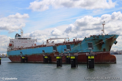
 Maersk Marmara
Current Status
Where is the vessel?
Maersk Marmara is currently in 10 nm E of Matagorda Bay, based on AIS data received about 17h ago.
Latest AIS update:
Current position: 28.35655° N, 96.19385° W (10 nm E of Matagorda Bay)
Average speed (last 7 days): Loading…
Average speed (last 30 days): Loading…
Vessel profile: Maersk Marmara is a Chemical Oil Products Tanker with dimensions 183m x 32m.
This page combines live AIS, route history, probable destination signals, nearby traffic, and port activity for practical vessel monitoring.
The current position of vessel Maersk Marmara is 28.35655 lat / -96.19385 lng. Updated: 2026-05-20 13:18:44 UTCNearest reference points:
- Near Matagorda Bay
- 14 nm E of PALACIOS
- Near Port Lavaca
Currently sailing under the flag of Singapore ![]()
Maersk Marmara built in 2006 year
Deadweight:
51182 tDetails:
Live Vessel Maersk Marmara Analytics (details, animations, etc.)
Recent AIS points (UTC):
2026-05-20 13:18:44 UTC · 28.35655, -96.19385 · SOG 0.7 kn · COG 52°2026-05-20 13:18:44 UTC · 28.35655, -96.19385 · SOG 0.7 kn · COG 52°
2026-05-20 13:18:44 UTC · 28.35655, -96.19385 · SOG 0.7 kn · COG 52°
2026-05-20 13:18:44 UTC · 28.35655, -96.19385 · SOG 0.7 kn · COG 52°