 vesseltracker.com
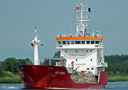
 Key Bora
Current Status
Where is the vessel?
Key Bora is currently in 23 nm W of Baba Point, based on AIS data received about 14h ago.
Latest AIS update:
Current position: 39.56158° N, 25.58492° E (23 nm W of Baba Point)
Average speed (last 7 days): Loading…
Average speed (last 30 days): Loading…
Vessel profile: Key Bora is a Chemical Oil Products Tanker with dimensions 93m x 14m.
This page combines live AIS, route history, probable destination signals, nearby traffic, and port activity for practical vessel monitoring.
The current position of vessel Key Bora is 39.56158 lat / 25.58492 lng. Updated: 2026-05-17 19:33:36 UTCNearest reference points:
- 16 nm NW of Sigri Lesvou
- 14 nm NW of Baba Point
- 14 nm SW of Bozcaada
Currently sailing under the flag of Gibraltar ![]()
Key Bora built in 2006 year
Deadweight:
3502 tDetails:
Live Vessel Key Bora Analytics (details, animations, etc.)
Recent AIS points (UTC):
2026-05-17 16:57:10 UTC · 39.91742, 25.84234 · SOG 9.2 kn · COG 229°2026-05-17 17:54:59 UTC · 39.79473, 25.73478 · SOG 9.5 kn · COG 214°
2026-05-17 19:10:25 UTC · 39.61804, 25.61720 · SOG 9.6 kn · COG 205°
2026-05-17 19:33:36 UTC · 39.56158, 25.58492 · SOG 9.6 kn · COG 206°