 CHANDRAKANT
Current Status
Where is the vessel?
CHANDRAKANT is currently in 37 nm NE of Craven Arms, based on AIS data received about 2d ago.
Latest AIS update:
Current position: 52.95585° N, 3.37079° E (37 nm NE of Craven Arms)
Average speed (last 7 days): Loading…
Average speed (last 30 days): Loading…
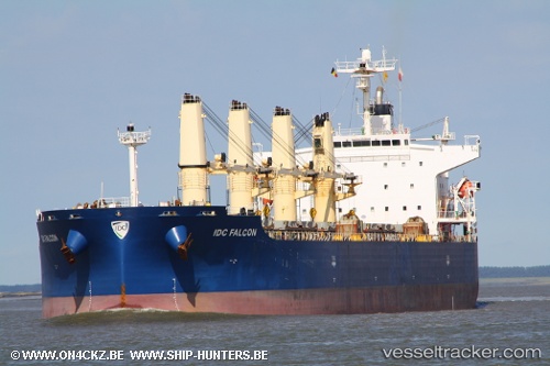
Vessel profile: CHANDRAKANT is a Bulk Carrier with dimensions 32m x 190m.
This page combines live AIS, route history, probable destination signals, nearby traffic, and port activity for practical vessel monitoring.
The current position of vessel CHANDRAKANT is 52.95585 lat / 3.37079 lng. Updated: 2026-05-18 17:54:38 UTCNearest reference points:
- 23 nm N of de Ruyter
- Near Craven Arms
- 22 nm W of Schoorl
Currently sailing under the flag of Marshall Islands ![]()
CHANDRAKANT built in 2006 year
Deadweight:
55803 tDetails:
Live Vessel CHANDRAKANT Analytics (details, animations, etc.)
Recent AIS points (UTC):
2026-05-18 17:54:38 UTC · 52.95585, 3.37079 · SOG 11.2 kn · COG 25°2026-05-18 17:54:38 UTC · 52.95585, 3.37079 · SOG 11.2 kn · COG 25°
2026-05-18 17:54:38 UTC · 52.95585, 3.37079 · SOG 11.2 kn · COG 25°
2026-05-18 17:54:38 UTC · 52.95585, 3.37079 · SOG 11.2 kn · COG 25°