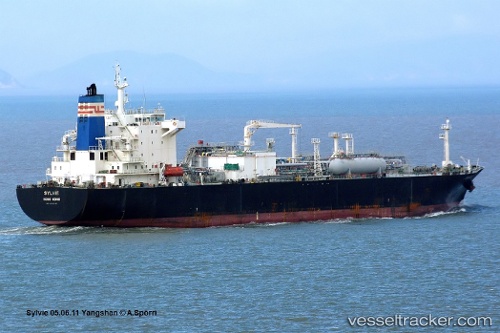
 PASCO SYLVIE
Current Status
Where is the vessel?
PASCO SYLVIE is currently in 42 nm SW of Potamos Antikithera, based on AIS data received about 14h ago.
Latest AIS update:
Current position: 35.42450° N, 22.63905° E (42 nm SW of Potamos Antikithera)
Average speed (last 7 days): Loading…
Average speed (last 30 days): Loading…
Vessel profile: PASCO SYLVIE is a Lpg Tanker with dimensions m x m.
This page combines live AIS, route history, probable destination signals, nearby traffic, and port activity for practical vessel monitoring.
The current position of vessel PASCO SYLVIE is 35.42450 lat / 22.63905 lng. Updated: 2026-05-18 18:22:13 UTCNearest reference points:
- 59 nm W of Paleochora
- Near Kythira
- 85 nm W of Paleochora
Currently sailing under the flag of Marshall Islands ![]()
Details:
Live Vessel PASCO SYLVIE Analytics (details, animations, etc.)
Recent AIS points (UTC):
2026-05-18 13:33:42 UTC · 35.53192, 22.61340 · SOG 1.2 kn · COG 232°2026-05-18 16:02:43 UTC · 35.47928, 22.62600 · SOG 1.4 kn · COG 232°
2026-05-18 16:56:14 UTC · 35.45837, 22.63030 · SOG 1.4 kn · COG 231°
2026-05-18 18:22:13 UTC · 35.42450, 22.63905 · SOG 1.4 kn · COG 232°