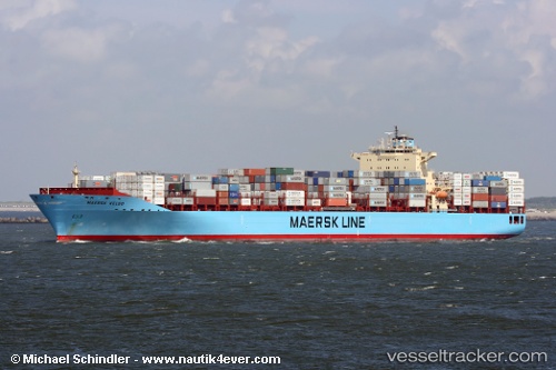
 Maersk Hartford
Current Status
Where is the vessel?
Maersk Hartford is currently in 322 nm S of Efpalion, based on AIS data received about 14h ago.
Latest AIS update:
Current position: 17.17660° N, 38.72408° W (322 nm S of Efpalion)
Average speed (last 7 days): Loading…
Average speed (last 30 days): Loading…
Vessel profile: Maersk Hartford is a Container Ship with dimensions 300m x 299m.
This page combines live AIS, route history, probable destination signals, nearby traffic, and port activity for practical vessel monitoring.
The current position of vessel Maersk Hartford is 17.17660 lat / -38.72408 lng. Updated: 2026-05-20 18:16:21 UTCNearest reference points:
- Open sea (no nearby ports in database)
- Open sea, approx. 401 nm off the nearest listed port
- Open sea, approx. 500 nm off the nearest listed port
Currently sailing under the flag of USA ![]()
Maersk Hartford built in 2007 year
Deadweight:
84783 tDetails:
Live Vessel Maersk Hartford Analytics (details, animations, etc.)
Recent AIS points (UTC):
2026-05-20 13:53:44 UTC · 16.25441, -37.77482 · SOG 17.6 kn · COG 312°2026-05-20 16:02:34 UTC · 16.70667, -38.24333 · SOG 17 kn · COG -1°
2026-05-20 16:38:26 UTC · 16.83730, -38.36880 · SOG 17.8 kn · COG 316°
2026-05-20 18:16:21 UTC · 17.17660, -38.72408 · SOG 17.6 kn · COG 314°