 CRONUS
Current Status
Where is the vessel?
CRONUS is currently in 134 nm S of Matara, based on AIS data received about 14h ago.
Latest AIS update:
Current position: 3.70111° N, 80.45448° E (134 nm S of Matara)
Average speed (last 7 days): Loading…
Average speed (last 30 days): Loading…
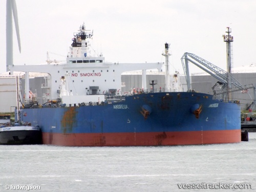
Vessel profile: CRONUS is a Crude Oil Tanker with dimensions m x m.
This page combines live AIS, route history, probable destination signals, nearby traffic, and port activity for practical vessel monitoring.
The current position of vessel CRONUS is 3.70111 lat / 80.45448 lng. Updated: 2026-05-19 19:42:06 UTCNearest reference points:
- 94 nm SW of Galle
- 36 nm S of Koggala
- 28 nm SW of Matara
Currently sailing under the flag of Marshall Islands ![]()
Details:
Live Vessel CRONUS Analytics (details, animations, etc.)
Recent AIS points (UTC):
2026-05-19 13:54:01 UTC · 2.90801, 81.11880 · SOG 10.7 kn · COG 315°2026-05-19 15:57:39 UTC · 3.18930, 80.88288 · SOG 10.6 kn · COG 313°
2026-05-19 15:57:39 UTC · 3.18930, 80.88288 · SOG 10.6 kn · COG 313°
2026-05-19 19:42:06 UTC · 3.70111, 80.45448 · SOG 10.7 kn · COG 315°