 PELAGIC TOPE
Current Status
Where is the vessel?
PELAGIC TOPE is currently in 130 nm S of Catalina Island, based on AIS data received about 14h ago.
Latest AIS update:
Current position: 16.19913° N, 69.05860° W (130 nm S of Catalina Island)
Average speed (last 7 days): Loading…
Average speed (last 30 days): Loading…
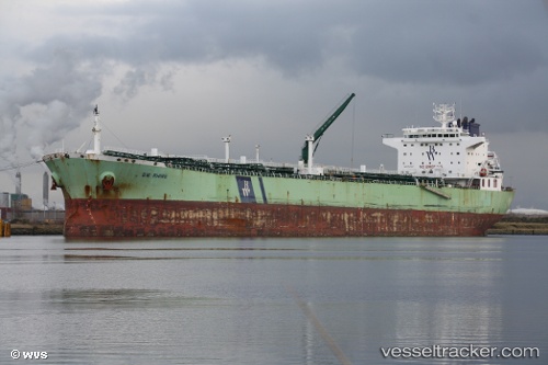
Vessel profile: PELAGIC TOPE is a Oil Products Tanker with dimensions 228m x 32m.
This page combines live AIS, route history, probable destination signals, nearby traffic, and port activity for practical vessel monitoring.
The current position of vessel PELAGIC TOPE is 16.19913 lat / -69.05860 lng. Updated: 2026-05-18 20:01:19 UTCNearest reference points:
- 148 nm N of Dorp Rincón
- Near CASA DE CAMPO
- Near Bahia De Las Calderas
Currently sailing under the flag of Cyprus ![]()
PELAGIC TOPE built in 2008 year
Deadweight:
76578 tDetails:
Live Vessel PELAGIC TOPE Analytics (details, animations, etc.)
Recent AIS points (UTC):
2026-05-18 17:03:11 UTC · 16.23258, -68.96743 · SOG 1.8 kn · COG 188°2026-05-18 17:19:40 UTC · 16.22948, -68.97565 · SOG 1.9 kn · COG 181°
2026-05-18 19:02:13 UTC · 16.20958, -69.02742 · SOG 2 kn · COG 181°
2026-05-18 20:01:19 UTC · 16.19913, -69.05860 · SOG 1.9 kn · COG 182°