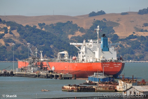
 ALJALAA
Current Status
Where is the vessel?
ALJALAA is currently in 154 nm W of Bolinao, based on AIS data received about 14h ago.
Latest AIS update:
Current position: 16.78585° N, 117.24227° E (154 nm W of Bolinao)
Average speed (last 7 days): Loading…
Average speed (last 30 days): Loading…
Vessel profile: ALJALAA is a Crude Oil Tanker with dimensions m x m.
This page combines live AIS, route history, probable destination signals, nearby traffic, and port activity for practical vessel monitoring.
The current position of vessel ALJALAA is 16.78585 lat / 117.24227 lng. Updated: 2026-05-18 22:22:38 UTCNearest reference points:
- 138 nm NW of Bolinao
- 222 nm W of Iba
- 34 nm W of Iba
Currently sailing under the flag of Marshall Islands ![]()
Details:
Live Vessel ALJALAA Analytics (details, animations, etc.)
Recent AIS points (UTC):
2026-05-18 19:48:55 UTC · 17.19333, 117.62500 · SOG 12 kn · COG -1°2026-05-18 19:52:24 UTC · 17.18413, 117.61846 · SOG 12.8 kn · COG -1°
2026-05-18 21:57:36 UTC · 16.86249, 117.29634 · SOG 13 kn · COG -1°
2026-05-18 22:22:38 UTC · 16.78585, 117.24227 · SOG 13.1 kn · COG -1°