 vesseltracker.com
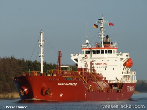
 B Gas Margrethe
Current Status
Where is the vessel?
B Gas Margrethe is currently in 14 nm N of Thorntonbank, based on AIS data received about 14h ago.
Latest AIS update:
Current position: 51.85355° N, 2.77137° E (14 nm N of Thorntonbank)
Average speed (last 7 days): Loading…
Average speed (last 30 days): Loading…
Vessel profile: B Gas Margrethe is a Lpg Tanker with dimensions 100m x 17m.
This page combines live AIS, route history, probable destination signals, nearby traffic, and port activity for practical vessel monitoring.
The current position of vessel B Gas Margrethe is 51.85355 lat / 2.77137 lng. Updated: 2026-05-17 21:43:20 UTCNearest reference points:
- 21 nm S of Craven Arms
- Near Thorntonbank
- Near Hunsdon
Currently sailing under the flag of Malta ![]()
B Gas Margrethe built in 2006 year
Deadweight:
4970 tDetails:
Live Vessel B Gas Margrethe Analytics (details, animations, etc.)
Recent AIS points (UTC):
2026-05-17 18:07:45 UTC · 52.57263, 2.13772 · SOG 13.7 kn · COG 159°2026-05-17 19:32:01 UTC · 52.26088, 2.31153 · SOG 14.5 kn · COG 155°
2026-05-17 20:08:43 UTC · 52.12788, 2.40854 · SOG 14.2 kn · COG 145°
2026-05-17 21:43:20 UTC · 51.85355, 2.77137 · SOG 13.2 kn · COG 119°